Connections
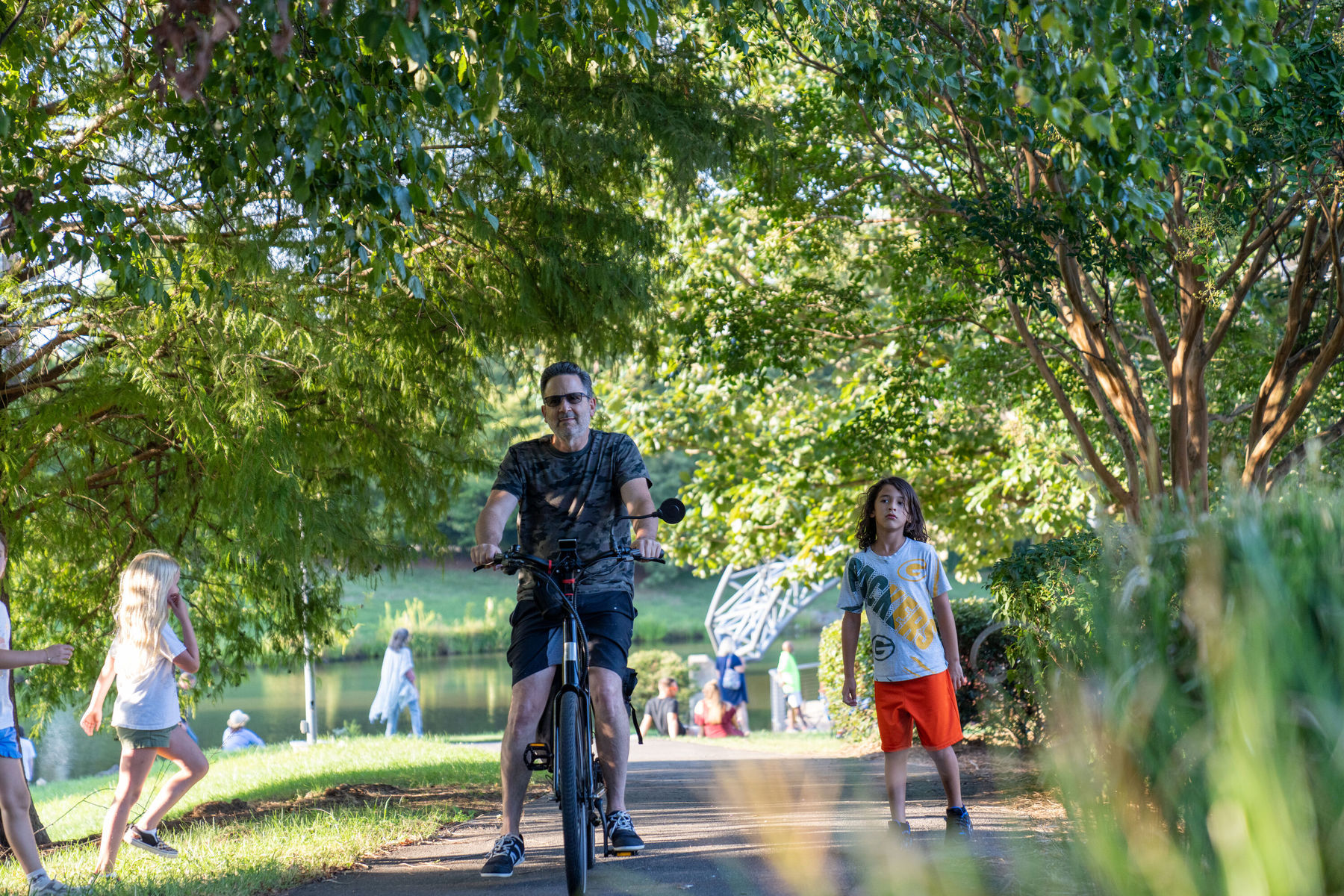
Improving conditions for pedestrians and cyclists.
The 1970s development of SouthPark, with its expanded roads and vast shopping mall parking, cemented a car-first precedent for the district that continued for decades. Today, SouthPark is known as a place to drive to and around. Evolving this experience by building better connectivity options will make active mobility not just possible but preferred.
To realize this transformation, the SouthPark Forward 2035 Vision Plan proposes six strategic initiatives:
1. SouthPark Loop
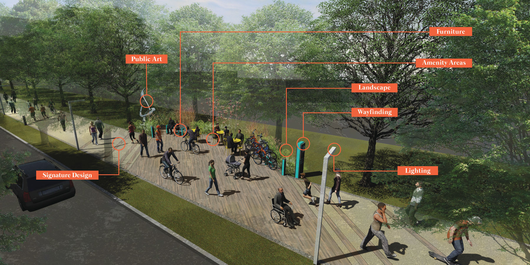
Connect SouthPark's destinations through an urban trail.
- The Loop is a 3 mile urban trail that creates and connects great places in the SouthPark area. This pedestrian-centered initiative will create a healthy, vibrant, colorful, and convenient activity center, featuring a variety of amenity zones, programming, and art. With the promise of connecting SouthPark’s experiences, the Loop will ensure SouthPark continues its maturation as a great destination for businesses, residents, and visitors.
- Through broad community partnerships and investments by private and public sector partners, the Loop has built momentum, particularly throughout a one-mile segment of its alignment that spans Cameron Valley Parkway through Rexford Road and Coca-Cola Plaza.
- Completing the first contiguous mile of the Loop will be key in showcasing the potential of this catalyst project. This initiative will connect the two completed Loop segments along Apex SouthPark and The Colony and tie into Highwoods’ and the City of Charlotte’s planned intersection improvements along Cameron Valley Parkway and Carnegie Boulevard.
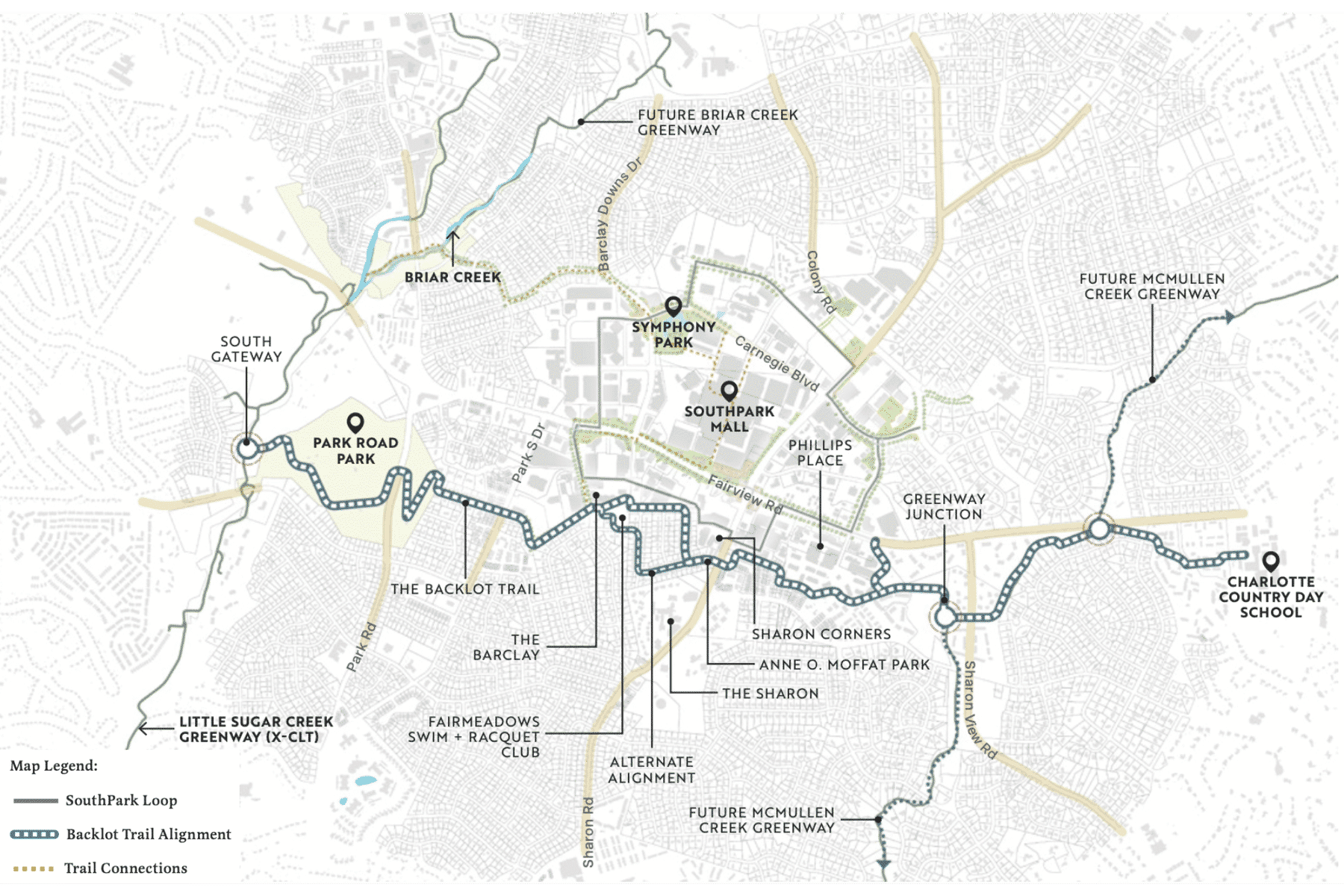
2. Greenway to Greenway
Unite the Cross Charlotte Trail (X-CLT) to McMullen Creek Greenway via the Backlot Trail.
- Offering a tranquil, nature-focused alternative to the vibrant SouthPark Loop, the Backlot Trail will connect the Cross Charlotte Trail to the future McMullen Creek Greenway, forming an integrated regional trail network.
- This pathway enriches neighborhoods south of Fairview Road with direct, active transport routes to key destinations such as Park Road Park, the Park Road Tennis Center, Fairmeadows Swim and Racquet Club, Phillips Place, Sharon Corners, Sharon Square, and Charlotte Country Day School.
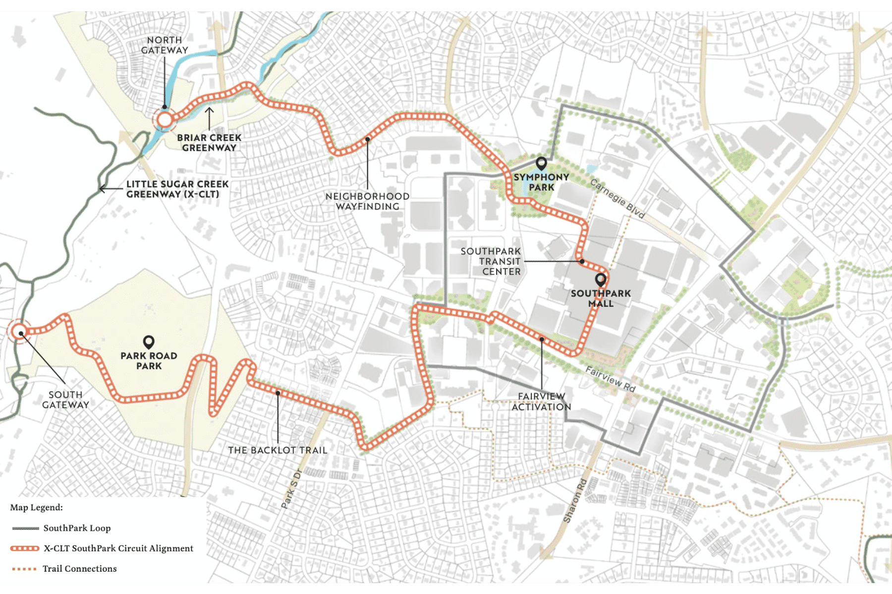
3. X-CLT to SouthPark Circuit
Establish SouthPark as a trail oriented destination on the Cross Charlotte Trail.
- SouthPark is poised to become a trail-centric hub, marked by distinct gateways, user-friendly amenities, and clear signage. The Cross Charlotte Trail-SouthPark Circuit will solidify this connection, featuring northern and southern eye-catching gateways that guide runners and walkers directly into SouthPark’s heart.
- This circuit incorporates parts of the Backlot Trail, Park Road Park, the SouthPark Loop, Fairview linear park, and a SouthPark Mall through routes linked to the SouthPark transit center. Additionally, it includes Symphony Park, a dedicated path along Barclay Downs Drive, and serene residential streets, culminating in a connection to the Briar Creek Greenway and looping back to the Cross Charlotte Trail.
- This design creates a figure-eight path that intersects the SouthPark Loop, enhancing travel options both within SouthPark and to the Cross Charlotte Trail.
4. Permeating SouthPark Mall
Break up the SouthPark superblock.
- The SouthPark Mall superblock, a barrier to network connectivity, compels inter-SouthPark trips out to Fairview Road, Sharon Road, Barclay Downs Drive, and Carnegie Boulevard, lengthening and discouraging travel for pedestrians and cyclists.
- Transforming part of the parking deck below the mall into a multi-use trail would halve distances between Carnegie Boulevard and Fairview Road, and could integrate with the CATS SouthPark Transit Center, allowing seamless transitions between buses, bikes, and other modes of travel.
- Features like improved lighting, vehicle separation, art, direct mall access, bike rentals, and storage would turn this space into a dynamic, multimodal artery at the district’s core.
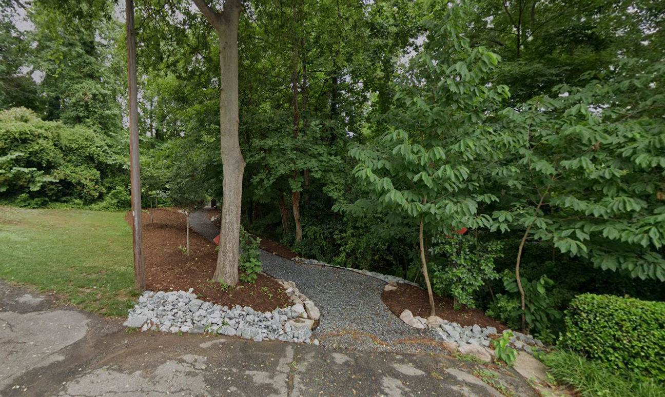
5. Living Ends
Open up dead ends between SouthPark's neighborhood's and mixed-use core.
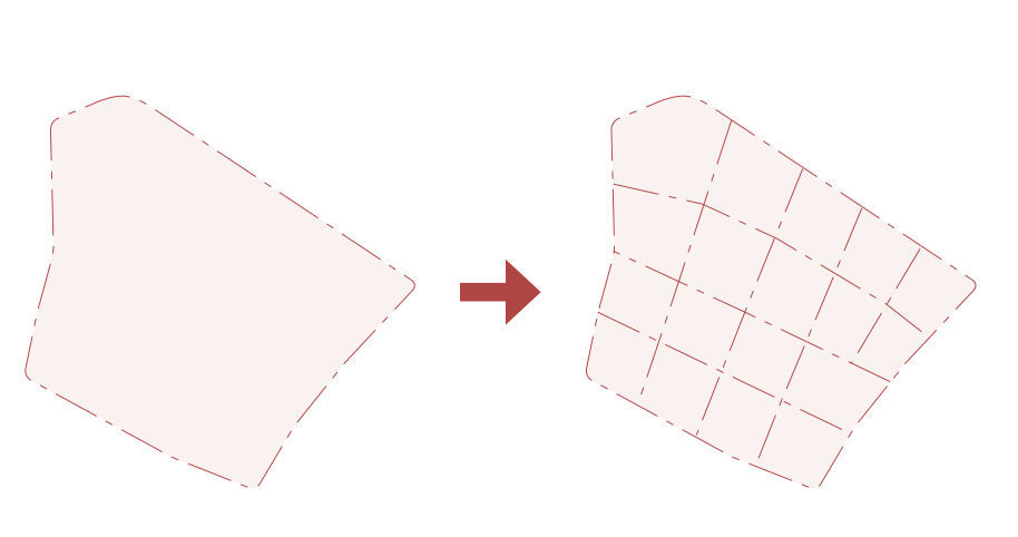
- SouthPark’s dead-end streets force residents to navigate busy, high-speed roads for longer distances to access the district’s core. This disconnect discourages walking and biking, since people are less likely to choose active transportation modes as travel time increases and comfort diminishes.
- While transforming every dead end into a complete street network isn’t feasible, “living ends” offer a solution. These are formalized multi-use paths providing safe and convenient pedestrian and bike links from residential areas through former dead ends to other network connections.
- Linking SouthPark’s residential neighborhoods to the commercial core is an idea the project team heard frequently from members of the SouthPark Association of Neighborhoods, who seek more convenient routes to SouthPark’s shopping and dining destinations.
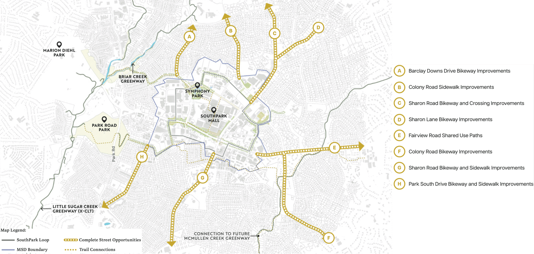
6. Connections In & Out
Welcome all modes through complete street retrofits.
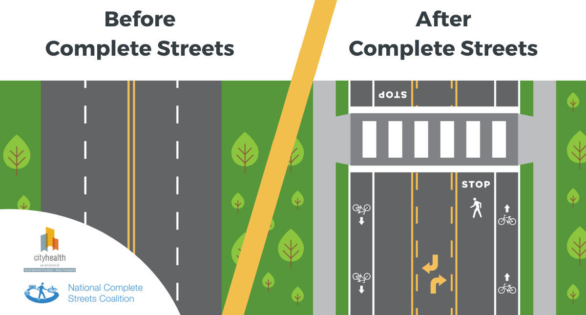
- Complete streets, accommodating cars, active mobility, and transit, are vital for cohesive urban travel. The 2018 CNIP study highlighted this, recommending transformations of key roads including Park South Drive and Barclay Downs Drive.
- All arterial roads leading into SouthPark should evolve into complete streets, boosting active transportation options for everyone. These upgrades, often feasible within existing public rights-of-way, can avoid extensive property acquisition and typically require simple changes like re-striping, without major curb or drainage modifications.